Click for more

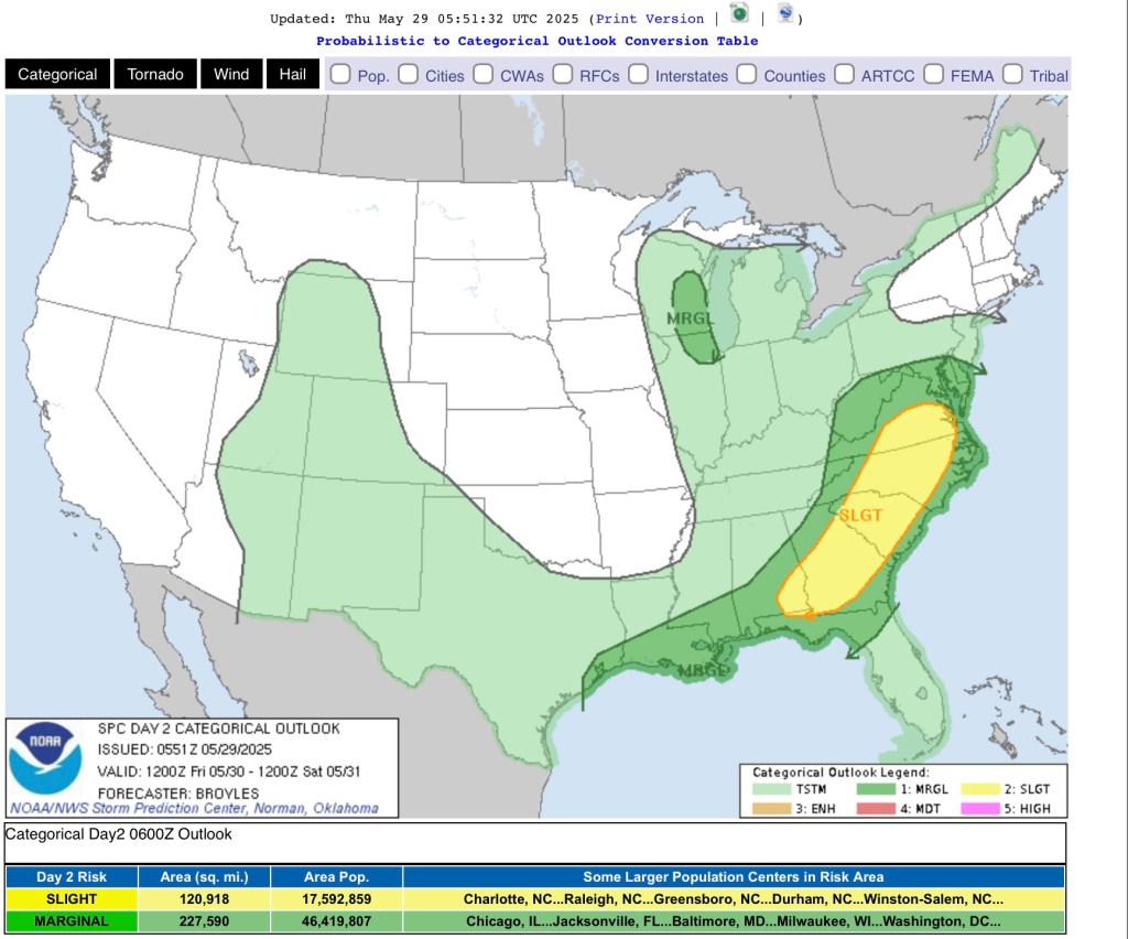
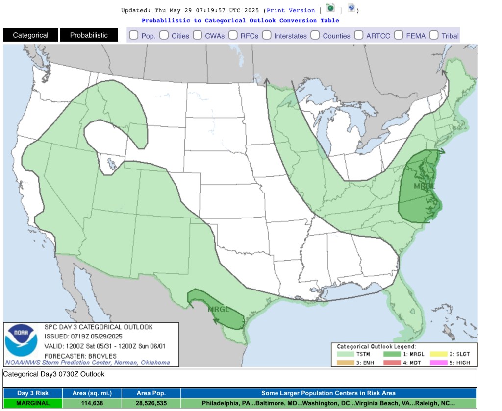
An active pattern will continue to impact the region over the next couple of days. Throughout Friday, an area of low pressure will move near the region influencing chances for scattered rain showers and general thunderstorms. Coverage of precipitation development will dwindle throughout the evening and overnight hours. By Saturday and into Sunday, a cold frontal boundary will sag into the region leading to occasional chances for isolated rain showers and pop-up thunderstorms, primarily focusing from southwestern Indiana to eastern Kentucky and Tennessee.
Behind the frontal boundary, high pressure will usher into the region Sunday leading to mainly dry conditions and partly sunny skies.
| Temperatures | Highs | Lows |
| Friday | Low 60s to low 70s | Upper 50s to low 60s |
| Saturday | Upper 60s to upper 70s | Middle 40s to middle 50s |
| Sunday | Upper 60s to low 70s | Middle 40s to middle 50s |
An otherwise spring weekend is in order as high temperatures rise within the 60s to 70s and low temperatures fall within the 40s to 50s. Cloud coverage may limit high temperatures with Sunday being the primary day of calm conditions.
Though Friday will kick off the weekend with dreary weather, high pressure is on the way to decrease those rain chances and bring out the sun☀️


Leave a comment